
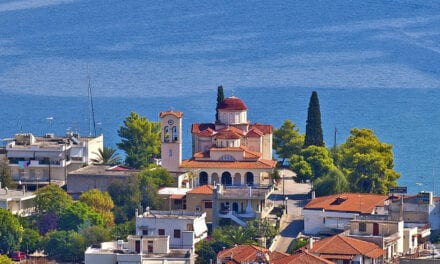
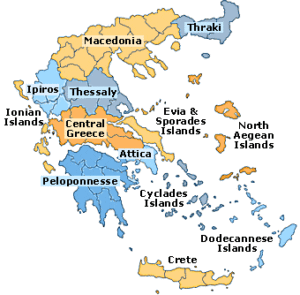
The southernmost end of eastern Europe’s mainland
To the Gates of Hades.
Bare rocks, rapid windy slopes and sharp cliffs… rough seas and haunted-like fortresses, but also calm fishing villages, not to mention the tempting glassy beaches… all will be your fellow travellers in a different journey that will rivet you, here in the southernmost end of Peloponnese, in the southernmost end of Balcans. We are on the waterless stony land of Mani where untamed people once lived…
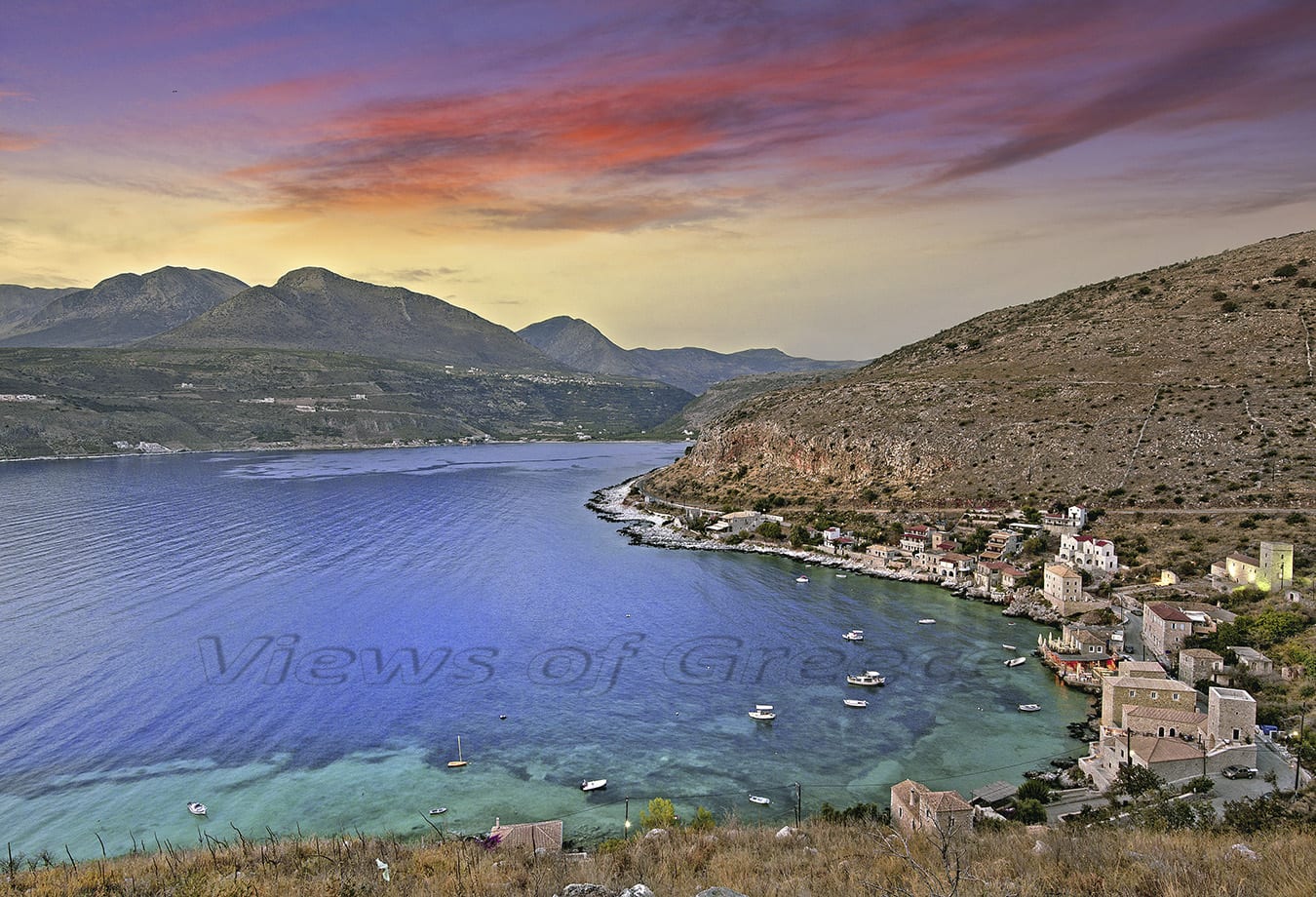
PHOTO: Theo Athanasiadis / Views Of Greece
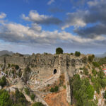
You leave the marine-town of Gythio behind and start walking a tightrope between fortresses’ frames and rock sites, poising at the same time on the edge of uncanny cliffs … You pass the Port of Quails (Port aux Cailles) and arrive in the land of “Akrotainaro” (Taenarus edge), the southernmost end of balcan peninsula!
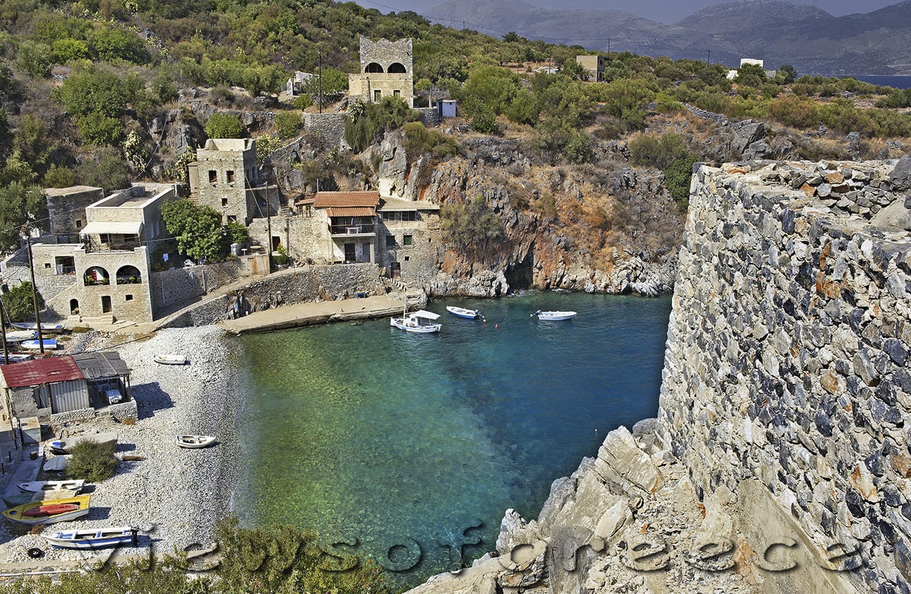
PHOTO: Theo Athanasiadis / Views Of Greece
For a moment you may think you have stepped on a mysterious land of a fairy tale…. But in fact you have found yourself in a real, easily accessible place, at Peloponnese in Greece…
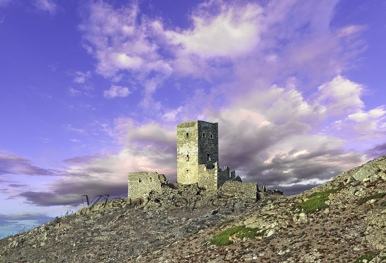
PHOTO: Theo Athanasiadis / Views Of Greece
Small signs will show you the path to “Faros” (the lighthouse), which dominates the cape, the path to the Death Oracle of Poseidon or to the Roman mosaic. But before you take to the road of Taenarus arrange to have water with you and a hat. The merciless sun of Mani(so called historically the region) parches this rough edge of Greece, where myths are still alive.
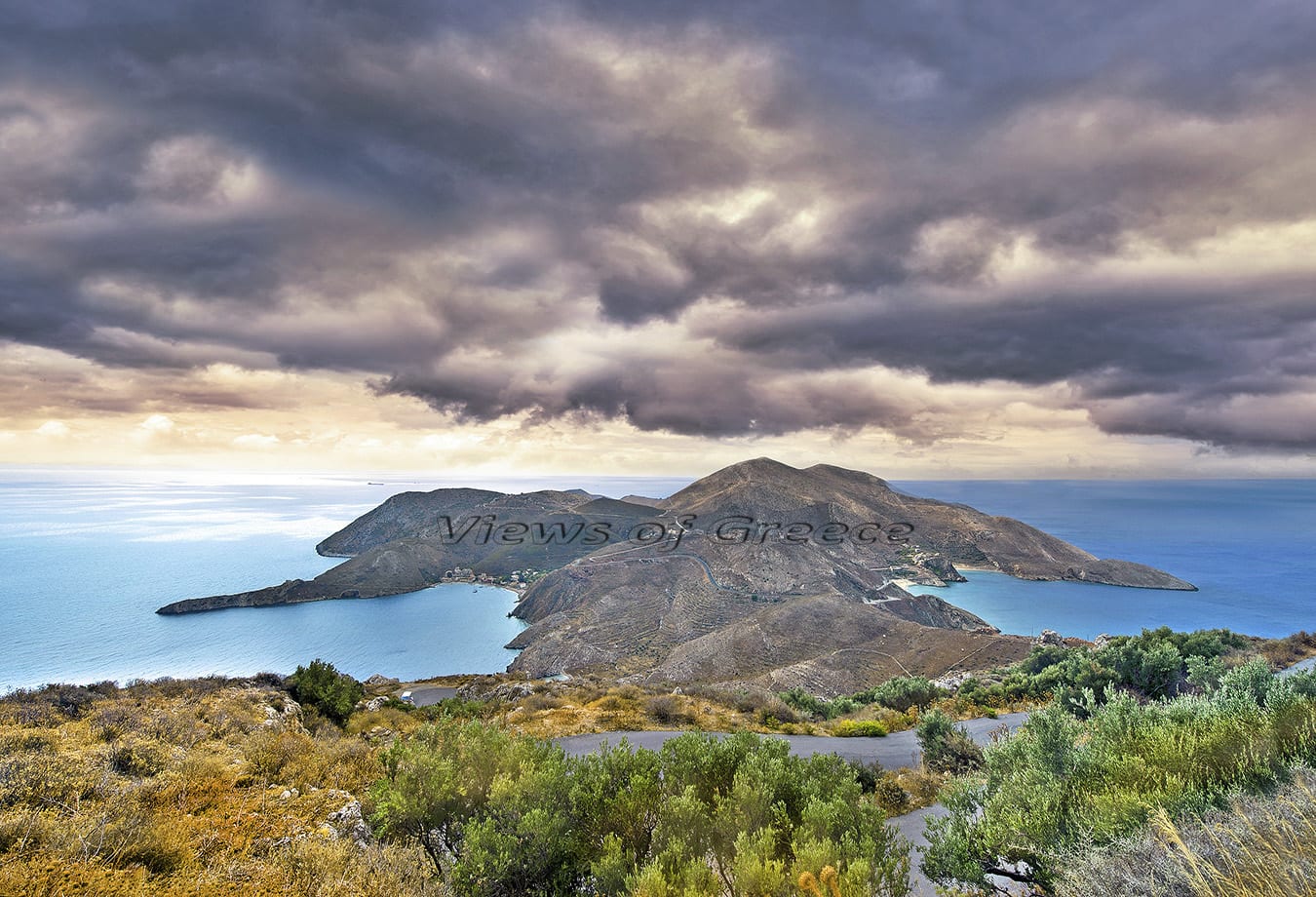
PHOTO: Theo Athanasiadis / Views Of Greece
Who Knows, you may suddenly find yourself in front of… the terrible Cerberus (monstrous dog of greek mythology), guardian of the gates of Hades!
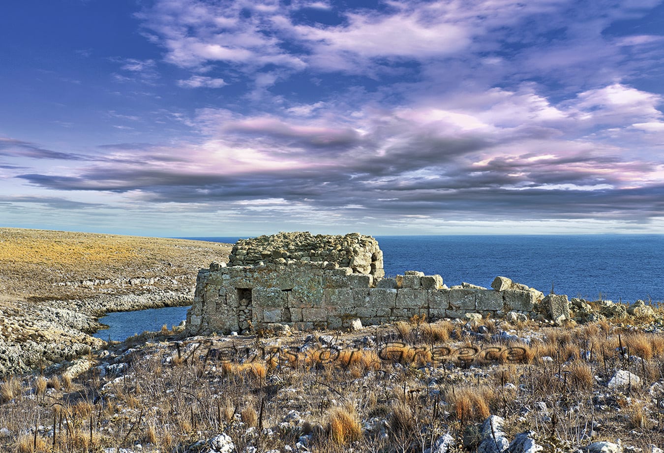
PHOTO: Theo Athanasiadis / Views Of Greece
Myths, legends and stories
Cape Taenarus has always excited imagination. The peninsula where it lies on, the biggest of the four ‘fingers’ of Peloponnese, seems like hooked desperately on to the sea’s bosom, as if it has once tried to escape from sinking, during the primeval geological upheavals of the Mediterranean basin.
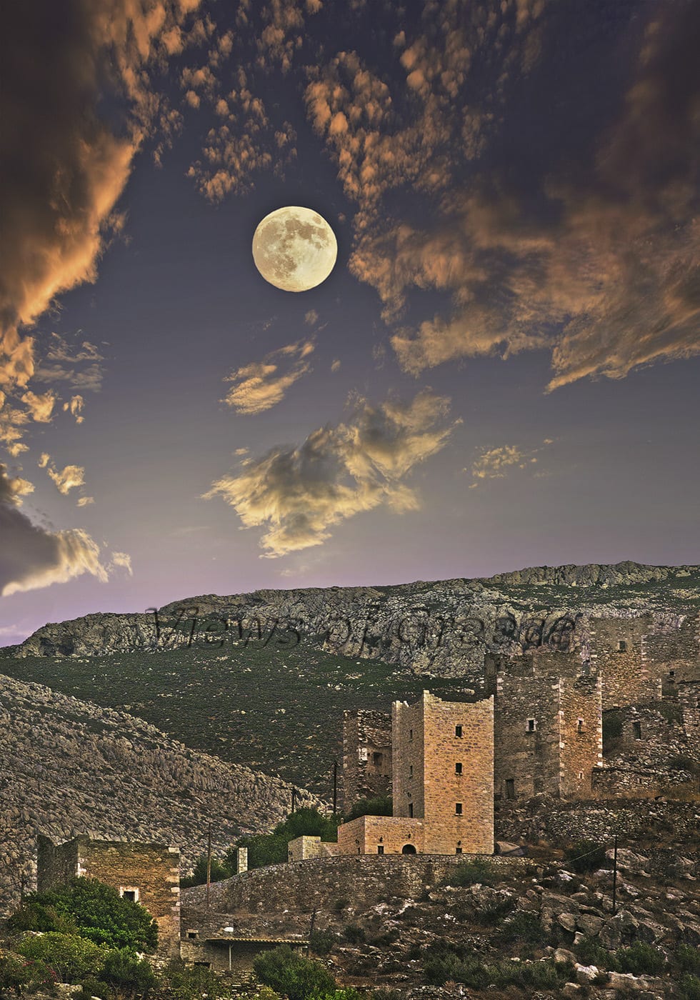
PHOTO: Theo Athanasiadis / Views Of Greece
According to greek mythology, the gates of Hades were found here, in an eerie sea-cave from which the demigod Hercules brought Cerberus up to the earth. The mythological reputation of the area was strengthened in classical times when -according to the ancient traveller Pausanias- the famous “Psychopompeio” (a sacred place for souls’ withdrawal) was operating.
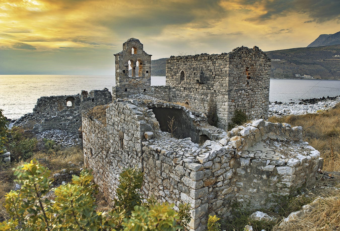
PHOTO: Theo Athanasiadis / Views Of Greece
According to the geographer Strabo, ancient navigators were using cape “Tainaro” to determine the maritime distances towards eastern Mediterranean. Subsequent sailors know Taenarus(Tainaro) under the name “Cavo-Matapas”, (from the Frankish word mate-passe or mate- pon, which means a difficult pass) as so called in the medieval portolan charts. The sea-caves of Taenarus’ coast offered moorage to Mani’s pirate-ships, the times when Greek pirates were knocking around the Aegean Sea.
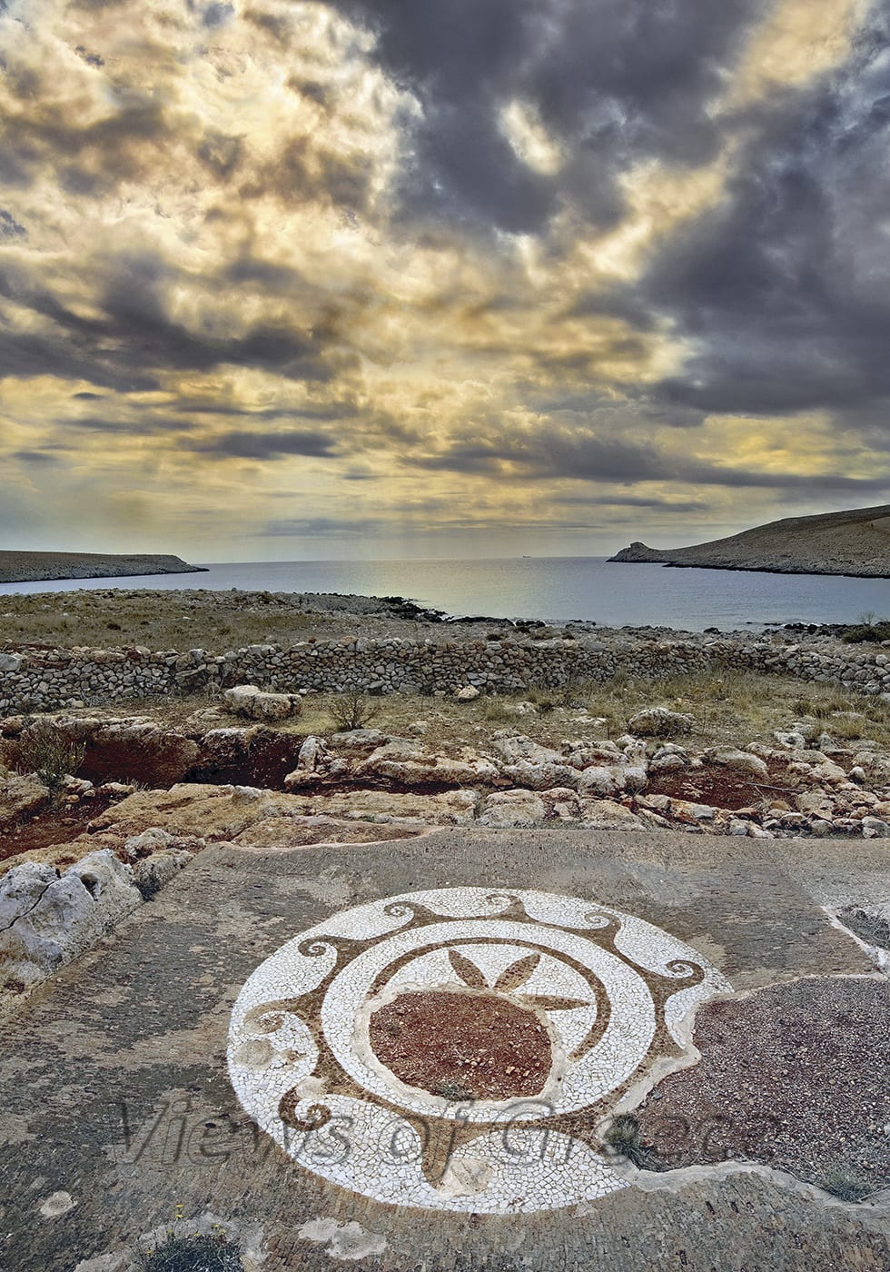
PHOTO: Theo Athanasiadis / Views Of Greece
They lied at anchor from “Porto-kagio” and drew alongside the Turkish frigates and the Venetian galleys(both conquerors of Greece) in order to take them by storm or to force them crash on the rocky cliffs. Sixty two kilometers southwest of Taenarus edge, the Mediterranean counts its deepest undersea ground (4850 m). The sea-tossed lighthouse, that pops up 16 meters high above the edge of the cliff, stands there since 1882.
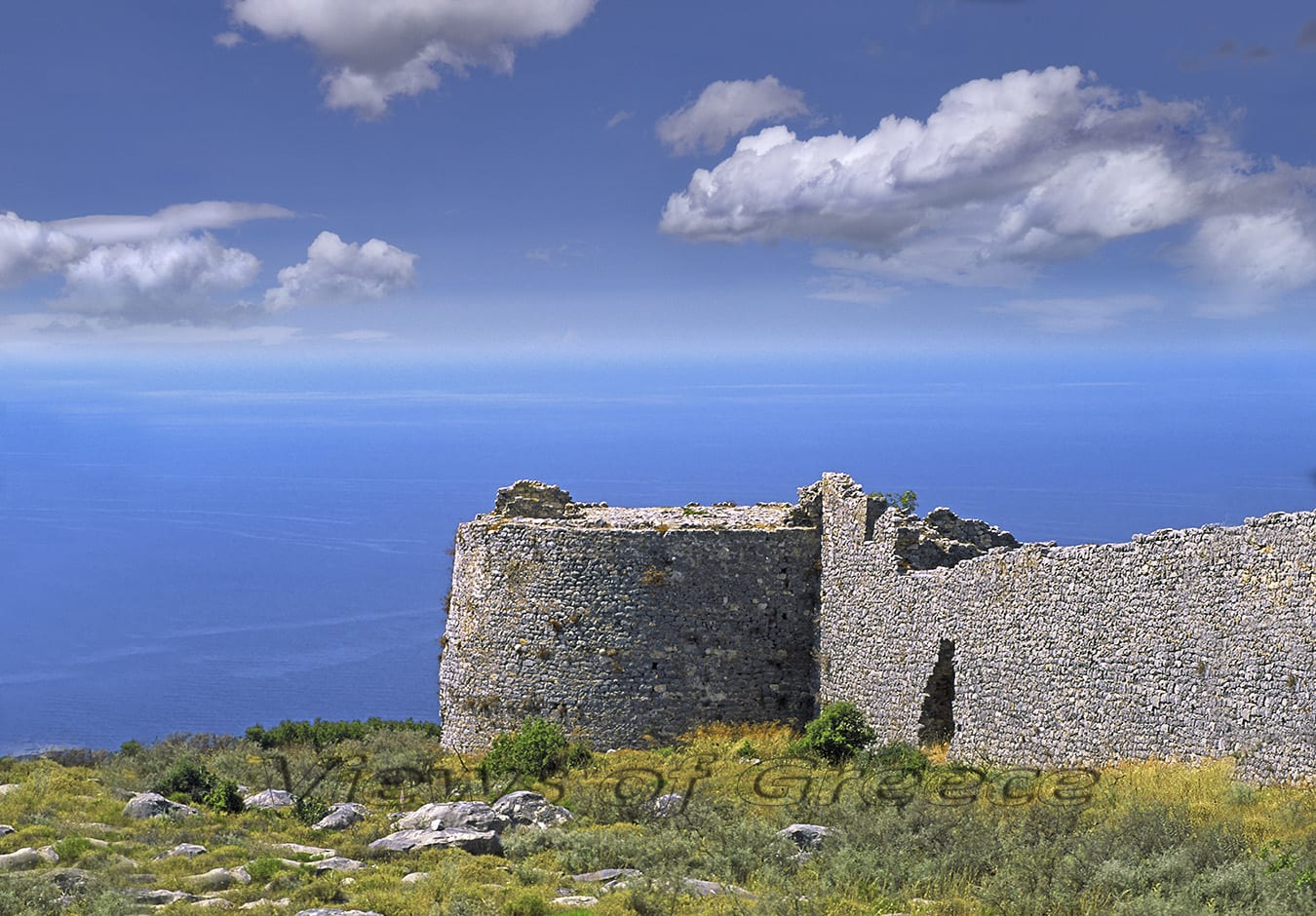
PHOTO: Theo Athanasiadis / Views Of Greece
“Maniates” (People of Mani), an unsubdued race
No other place in Greece as Mani has so much linked its rough bas-relief to the lofty and inaccessible character of its people.
The villages of Mani’s dwellers put up their simple gray geometrical shape vertically on the earth in a solid defense order. Each building keeps its autonomy, but all together look like ramparts of a single castle.
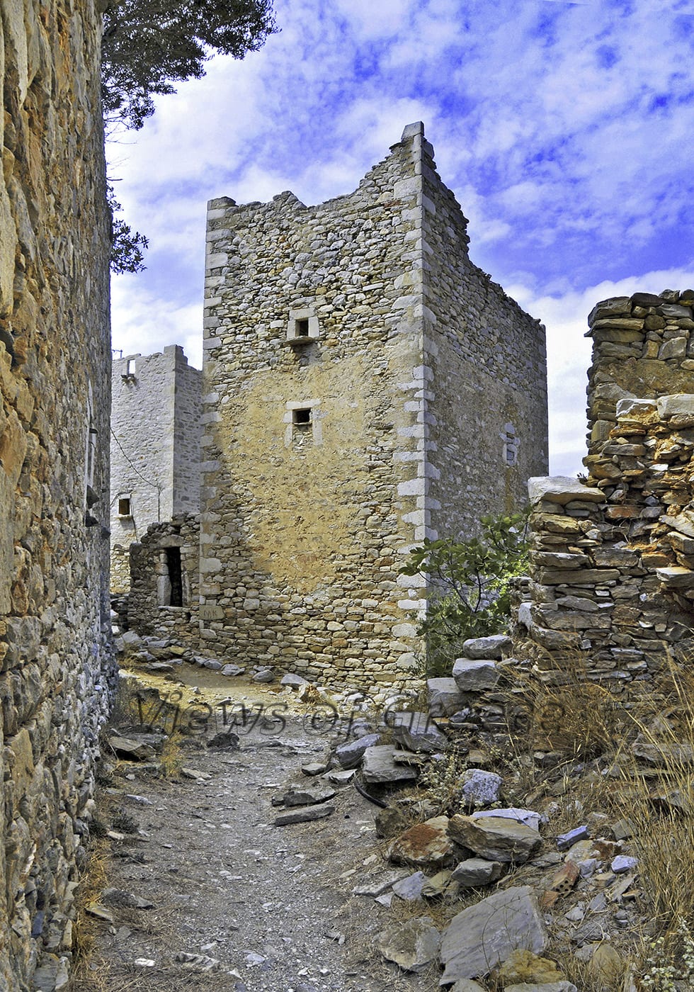
PHOTO: Theo Athanasiadis / Views Of Greece
The typical Mani’s tower is an evolution of the ancient residential settlement, adapted to the difficult circumstances of the troubled years of the Ottoman ruling. This high stoned impressive construction with small windows and doors, embrasures, bastions and “zematistres”(small openings on the wall for throwing hot oil to the enemy), were resistant in wear of time and in any human attack.
PHOTO: Theo Athanasiadis / Views Of Greece
The life of Mani’s people was once a constant war preparation. Turks, pirates, and internal disputes were permanent threats. In such difficult years, people urged by the need to secure their survival built their shelters in a way that could be fortresses, barracks and homes for their families at the same time.
The heart of Mani’s peculiar society was the family. The more powerful and numerous it was, the greater influence exerted to the decisions of the community.
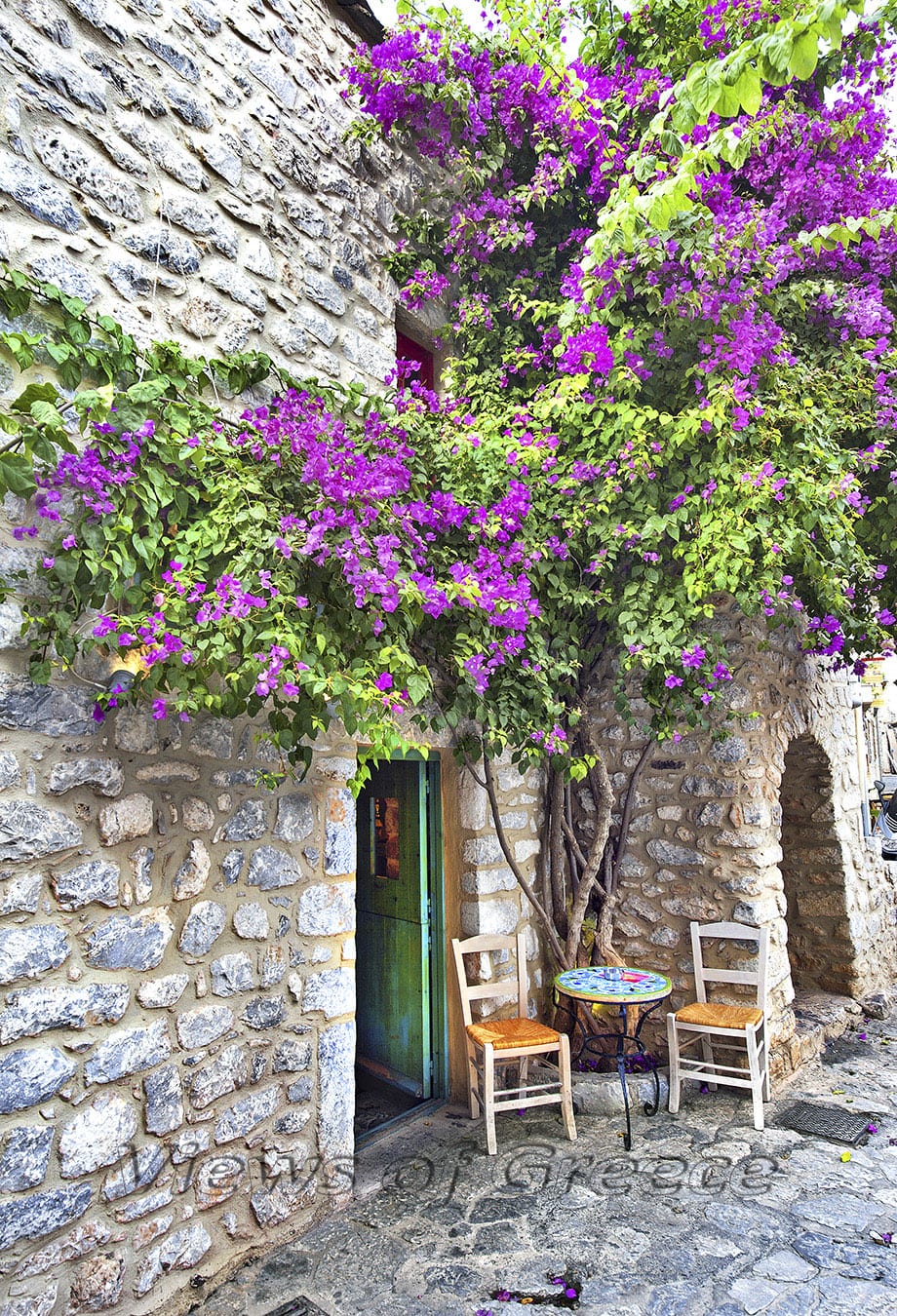
PHOTO: Theo Athanasiadis / Views Of Greece
Don’t miss
Diros Caves
Southern of Tainaro, near the town of Areopolis(11 km) you will find the famous water-caves of Diros (total lenghth of visiting chambers 3.5 km). Touring on boats in the chambers of “Vlyhada” cave is a breathtaking experience (tel. +30.27330-52222). Entrance 12 euros. Visiting hours: every day (October-May: 8:30-15:00 & June-Sept: 8:30 to 17:30). http://www.showcaves.gr .
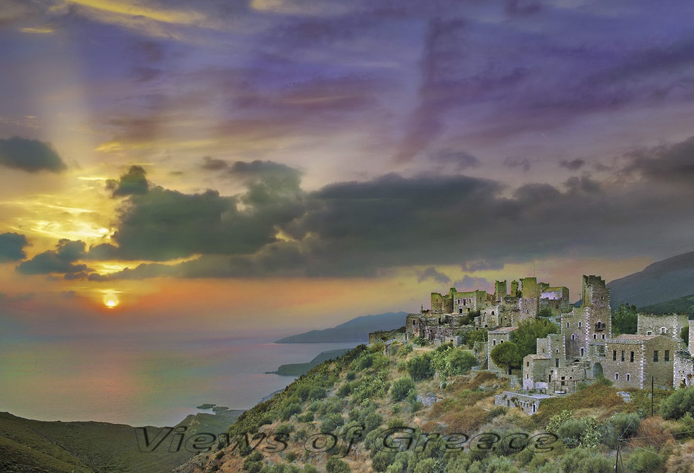
PHOTO: Theo Athanasiadis / Views Of Greece
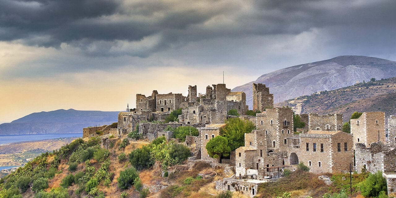
The towers of Vathia
Driving on the road to Tainaro, your will fix your gaze at the towers of Vathia, one of the most impressive traditional villages of Greece, with more than forty, three-storey or four-storey tower-like residences.
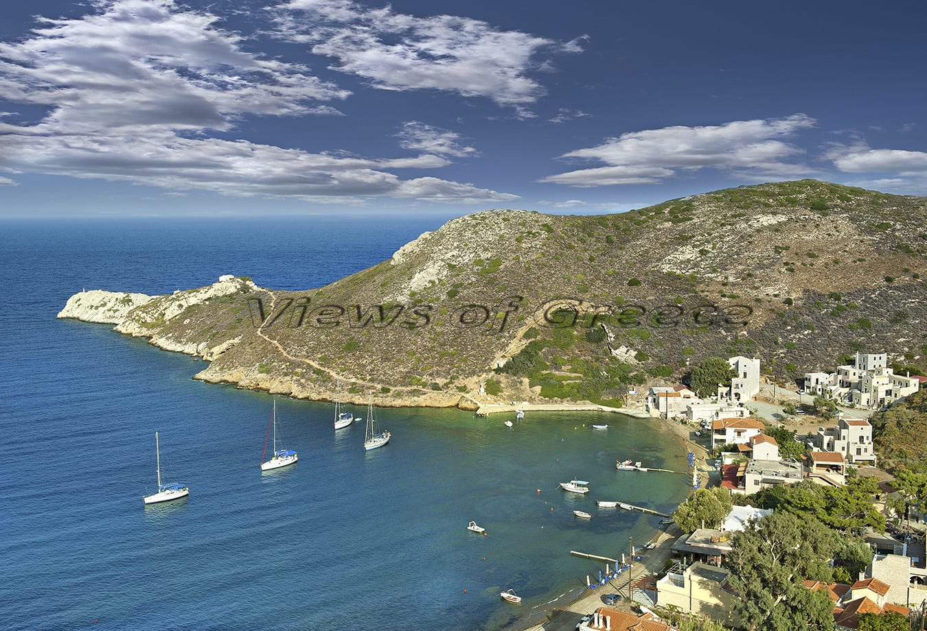
PHOTO: Theo Athanasiadis / Views Of Greece
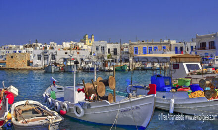
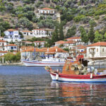
Porto Cayo (Port of Quails) – Limeni
North of Tainaro meet the picturesque Porto Kagio and north of Areopolis find the beautiful Limeni, two of the few coastal villages of Mani, both having food and lodging infrastructure.
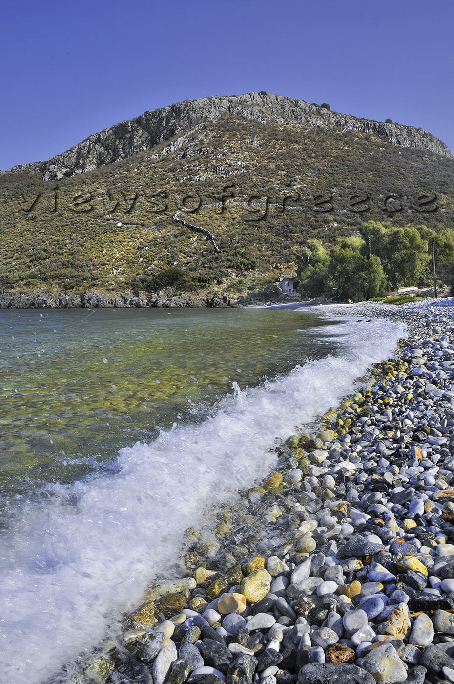
PHOTO: Theo Athanasiadis / Views Of Greece
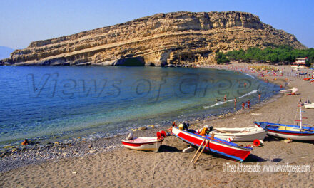
Best beaches
At the Caves of Diros the beach with white pebbles and crystal clear waters is excellent, but crowded.
Close to Vathia, you can find “Kapoi” beach with very small pebbles and dark sand.
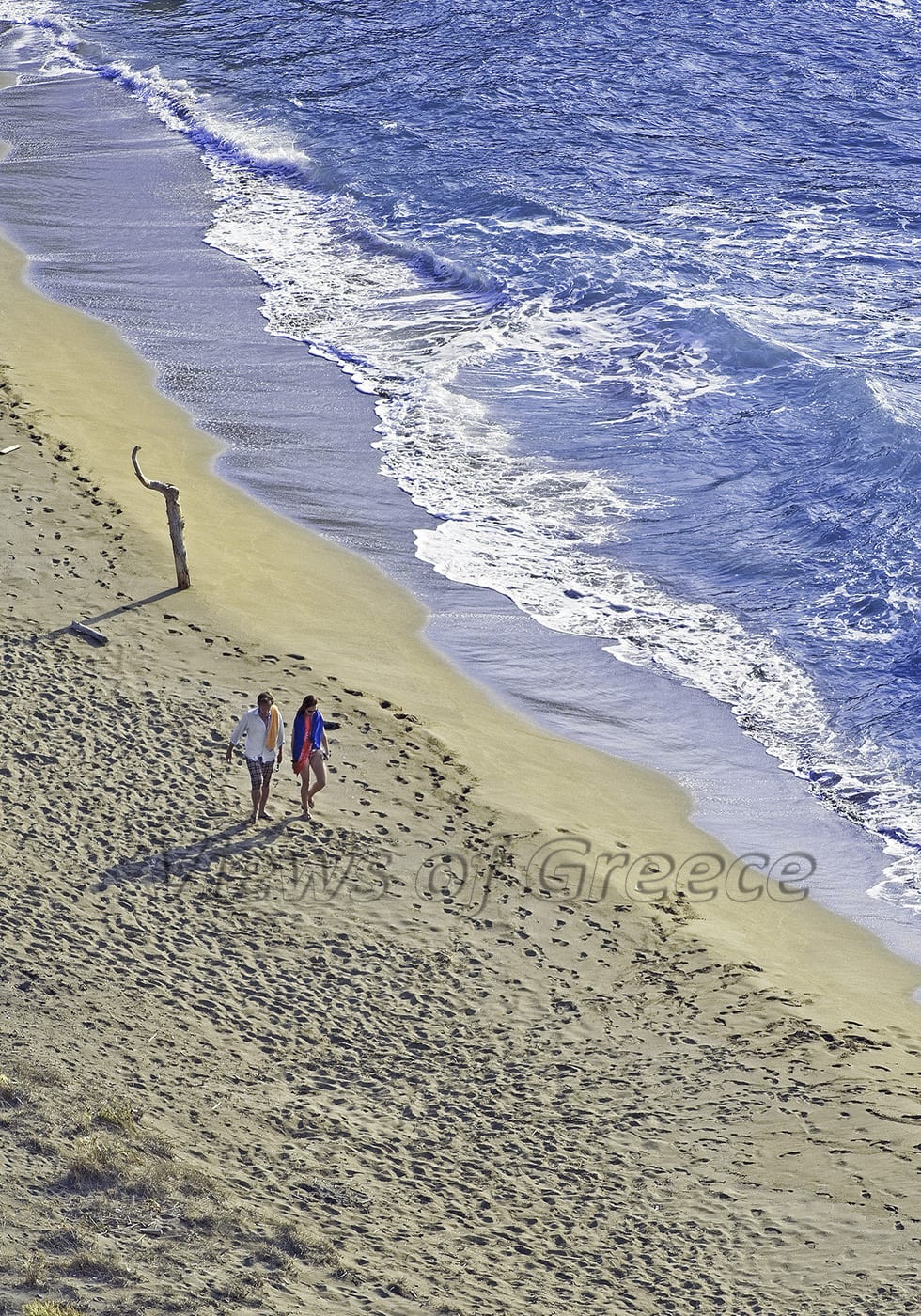
PHOTO: Theo Athanasiadis / Views Of Greece
At Tainaro the best beach is “Psili Ammos” (“Fine Sand”), which is approached from Marmari village, while below the Temple of Poseidon the tiny “Sternes” beach lays, perfect for a cool dip after hiking at the cape.
In front of the village of Porto Kagio a sheltered bay with sand and pebbles is expanding.
An unforgettable excursion
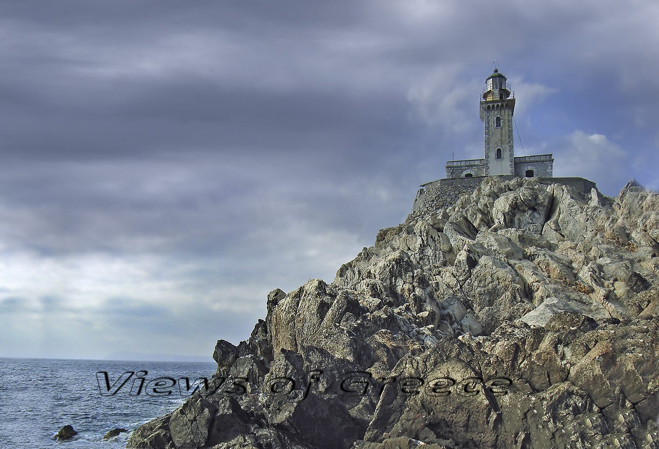
PHOTO: Theo Athanasiadis / Views Of Greece
By boat to Tainaro
At the point where the road ends and the trails begin, you will find a small settlement called “Kokinogia” with a tavern. The tavern’s owner can also take you a trip with his craft to Cape Teanerus and to the lighthouse (trips available upon request and if the weather allows it). Tel + 30 27330-53064, ask for Panagiotis.
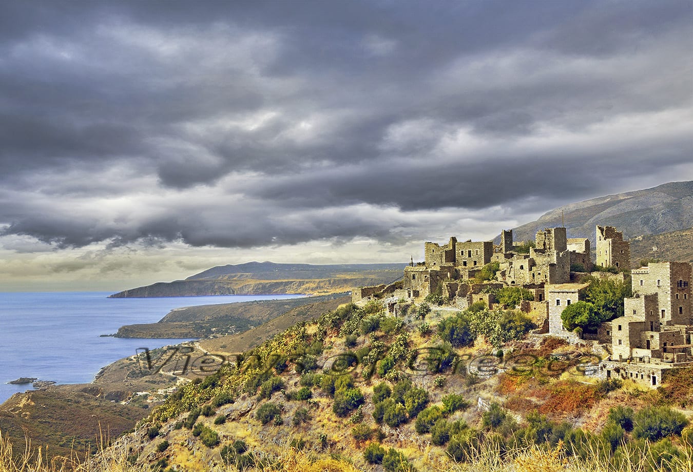
PHOTO: Theo Athanasiadis / Views Of Greece
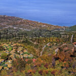
By car up in the mountains
Away from beaches and coastal hotels, far from rocks and waves, there is a hidden driving course that reveals authentic pictures like faded gravures, of an old-times world.
Visit the originally traditional village of Laya and then following the narrow tarmac road, that is crawling like snake among precipices, you will reach the villages Tsikkalia, Marathos, Liontakis with its watch towers, to end up at the godforsaken ruins of Pepo village. A stamp of authenticity on Liontakis, Mountanistika and Pepo villages.
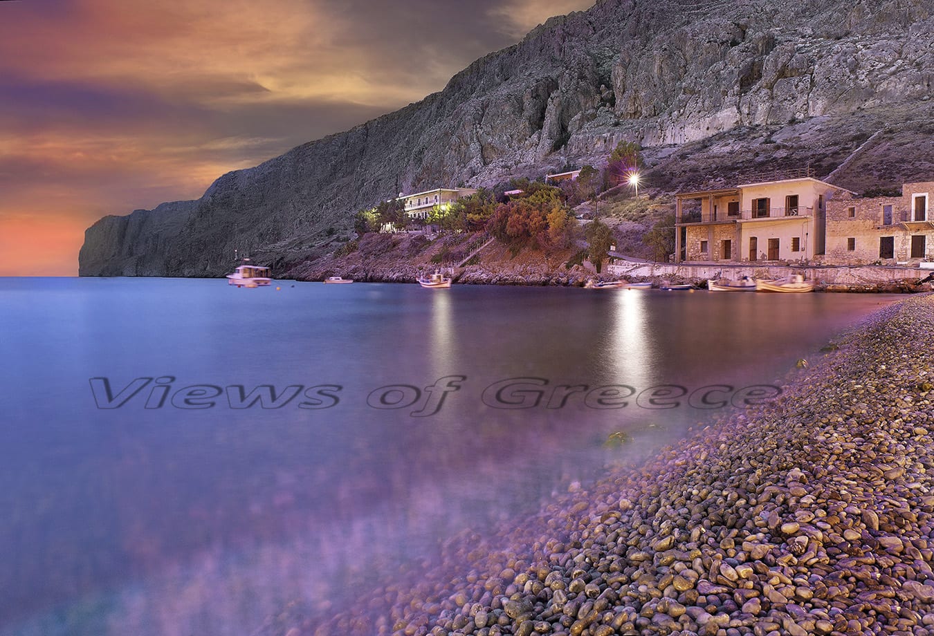
PHOTO: Theo Athanasiadis / Views Of Greece
What we did not like
Bad copies of Mani’s towers constantly built up, are sprouted very often lately around or inside very old settlements. Such constructions with doses of Modern-Greeks’ vanity are obviously in contraditction of the Dorian environment of Mani.
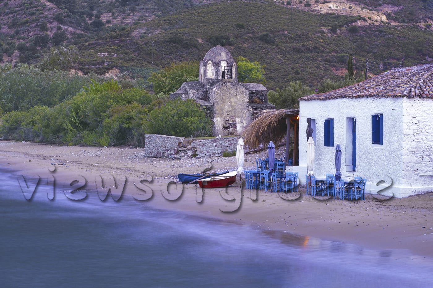
PHOTO: Theo Athanasiadis / Views Of Greece
Local flavors
Try the spicy “Siglino”. It is smoked, salted pork, flavored with orange and sage, preserved in jars with olive oil. Ask to be served “Regali” made from lamb entrails cooked in olive oil, red wine and spices. Finally, “Galatopita” for dessert, a sweet (pie-like) made from fresh goat milk and semolina.
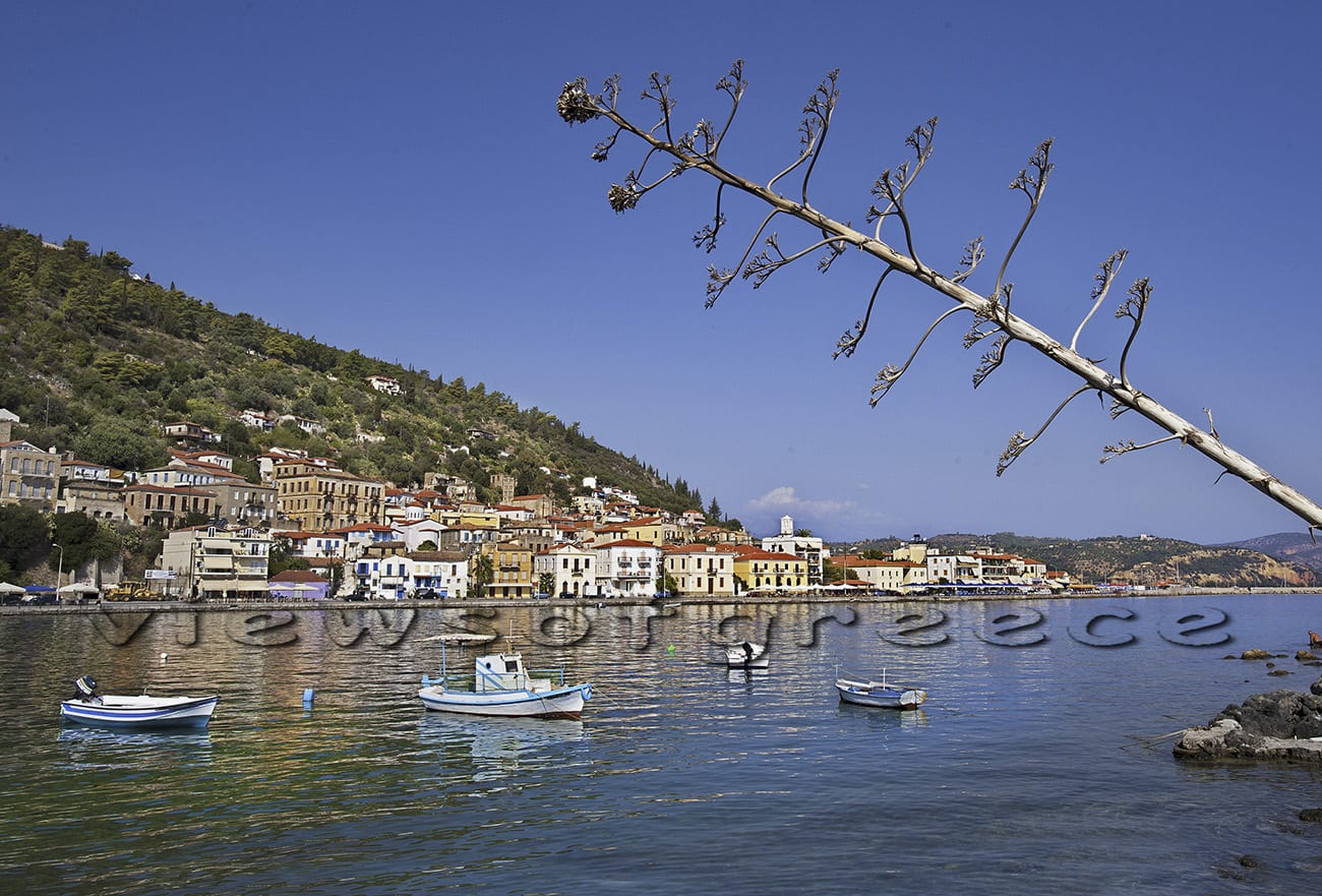
PHOTO: Theo Athanasiadis / Views Of Greece
How to go
The small town of Gythio, considered as the gateway to Mani, is 265 km (almost 4 hours drive) from Athens. If you travel by car or motor caravan, the route you will follow is Athens – Corinth – Tripoli – Sparta-Gythio. Up to Tripoli you will drive in a highway. Then attention is needed as the road has no intermediate protective barrier. From Athens the intercity bus (KTEL) goes up to Gythio (5 hours). Information on schedules and prices http://ktel-lakonias.gr
Tips for drivers
Tarmac roads lead to Tainaro and to most of the villages of Mani, but are full of turns and in some cases they are very narrow.
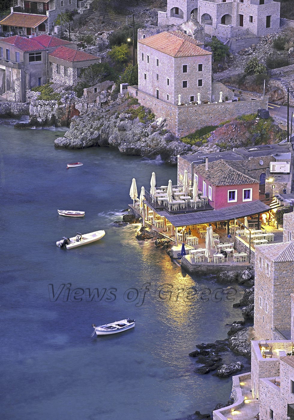
PHOTO: Theo Athanasiadis / Views Of Greece
Distances between the main villages
Areopolis – Tainaro: 40 km
Gythio – Tainaro: 65 km
Tainaro – Vathia: 8 km
PHOTO: Theo Athanasiadis / Views Of Greece
According to the law:2121/1993 and the international treaty signed in Bern (which has been ratified with the law:100/1975) reproduction of this work is forbidden in any way, partially or on the whole, including texts or photographs alike without the written consent of the creator. Intellectual property is aquired without formalities and without the need for provision prohibiting its disputation.
Copyright photo: Theo Athanasiadis / Views Of Greece
Copyright text: Germaine Alexakis/ Views Of Greece
“Views Of Greece” travel photojournalism – Discover the real Greece with the experts


